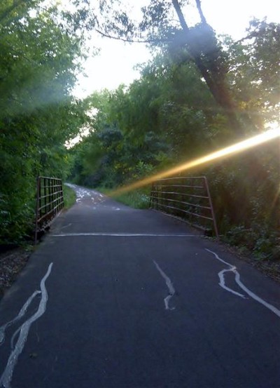
The Reno Rail Trail is a beautiful and relaxing section of the trail. From lovely flowering trees and a beautifully decorated trail head to relaxing colorful benches along the way, it is the perfect place to get away from it all. In this section of the NETT you will find a little library where you can borrow a book, sit back, and enjoy nature. Nearby is a nice water fountain (handicap accessible) for a cool drink of water. On the west end of the Reno Rail Trail we also have a new and handsomely-crafted covered picnic area. It is ideal for a relaxing picnic yet also provides protection from our unpredictable Texas weather.
Our trail head is near Sonic and our fabulous Nita’s Diner for those needing to stop in for a warm meal. Reno City Hall is also nearby for tourist information or other needs.
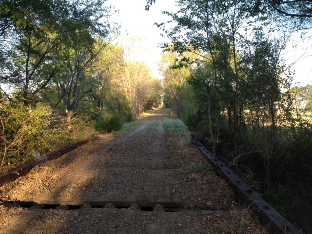
Reno’s Rail Trail starts at Reno’s West city limit. Proceed East before reaching Key West Rd. On the right is an outdoor picnic pavilion. Proceed East to Airport Rd and cross Airport Rd. 0.5 miles to the Reno East city limit. Then you are on the Lamar County Prairiland section that extends 3.5 miles to Blossom’s West city limit. Continue East through the heart of the city of Blossom, paralleling US Hwy 82 to its East city limit. From the beginning of the Paris section to the end of the Blossom section is 12.5 miles of hard surfaced asphalt-sand material. There are plenty of park benches for rest areas and water fountains.
The Prairiland Trail connects the Reno Rail Trail to the Blossom Rail Trail.
The City of Blossom trail begins at County Road 13200 to the West and South Bois d’Arc to the East. Our trail is 1.5 miles of primarily tree-lined asphalt maintained by the City. Your journey along our trail will include such sights and experiences as the Dan Bolton Memorial Shed, Blossom City Park, Blossom Library, downtown, and Blossom City Hall. Blossom Elementary School is in close proximity to the trail and students can take advantage of this pathway as a safe route to school. The City Park offers picnic tables, a covered pavilion, parking, a playground, and limited water and limited electricity. Parking is also available at each trail head.
1.8 miles (Reno Rail Trail); 4.7 miles (Reno to Blossom trail)
The Reno Rail Trail and Prairiland Trail are all-weather surface. Bridges are all in good shape.
The City of Blossom trail is 1.5 miles of asphalt.
Hiking, cycling, running.
Reno Rail Trail: Airport Rd, one block south of Hwy 82 in Reno. Sylvan Rd.
City of Blossom Trail: County Road 13200 on the West and South Bois d’Arc Street on the East
Reno: Limited parking at Airport Rd trail head. Water fountain and port a potty available.
Blossom: Limited parking at trail head
City of BlossomCampsites
Reno: The public is asked to contact the person listed for each trail town to make reservations for camping. A complete list of campsites and contact information is posted on the NETT website. There are no campsites listed for the city of Reno.
Blossom: Tent camping is welcome at the City Park but electricity and water are limited and not sufficient for recreational vehicle camping.
Contact information for camping in Blossom (City of Blossom):
Contact Person – Stacy Prestridge (903) 982.5900
Emergency/ Medical – 9-1-1
Reno Police Department – (903)785-1744 – office
City of Blossom – 903.982.5900
Lamar County Sheriff’s Department – (903) 737-2400
| [awesome-weather location=”Reno, TX” units=”F” size=”tall” override_title=”Reno, TX” forecast_days=3 hide_stats=false background=0] | [awesome-weather location=”Blossom, TX” units=”F” size=”tall” override_title=”Blossom, TX” forecast_days=3 hide_stats=false background=0] |